
Search Neptune Township Streets
Use the physical parcel as the starting point for a Neptune Township street search. The county’s consolidated property search accepts a township and address, including a street name or part of one. It supplies the parcel lead. The map then helps distinguish a similarly named road, a corner lot, or a split parcel. Recorded instruments belong to a separate system. A name on an assessor result can describe an owner or mailing contact, while a name on an instrument can be a party to that document. Neither label alone establishes current occupancy.
For a street-by-street search, save the municipality, situs address, block, lot, qualifier, owner-name lead, and any displayed mailing address before moving on. These are the values that let the next search be checked instead of guessed. The process also works when a familiar neighborhood name appears in a newspaper or old directory, because the legal record search remains under Neptune Township.
- Open the Monmouth County Consolidated Records Search and select Neptune Township. Enter the address or just the street name to find the property lead.
- Confirm the physical parcel in the Monmouth County GIS viewer. Check the map position before treating two similar addresses as one parcel.
- Keep the block, lot, qualifier, situs, and mailing values as separate notes. A mailing route can point outside Neptune Township while the parcel remains inside it.
- Search the same block and lot or party name in OPRS Property Records for the recorded instrument trail.
- For a dated household clue, consult library directories, maps, newspapers, or the official voter process only within its stated limits.
Neptune Township Address Fields
The consolidated search is the most direct Neptune Township property lead because its modes are built around the keys a street search produces. Address mode requires Township Name and address text. Block and Lot mode requires Township Name, block, and lot, with a qualifier available. Name mode uses Township Name and an owner name or part of a name. Its map mode offers zoom, right-click location, and a radius selection. These functions are parcel tools, not a roster of people on a road.
| Search mode | Fields or controls | Street-directory use |
|---|---|---|
| Address | Township Name; address text; partial street accepted | Find the initial parcel and map/property result. |
| Block and lot | Township Name; block; lot; optional qualifier | Resolve an exact parcel after a broad street search. |
| Owner | Township Name; full or partial owner name | Check a tax-roll lead and spelling variation. |
| Map | Zoom; right-click location; radius | Compare a street result with nearby parcel geometry. |
| GIS viewer | Dynamic map, search, layers, and parcel pop-up expected | Confirm geometry and adjacency; visible fields were not captured in text research. |
The field list is deliberately narrower than a person search. Preserve what the system returns, then use the Neptune Tax Office for assessment-routing questions. The office directs assessment questions to the local assessor, while the county systems hold the parcel and instrument paths.
Partial street entries are useful when an old source omits a number. Match the map result and the block and lot before treating a partial address as the same Neptune Township parcel.
Neptune Township Parcel Terms
Parcel vocabulary makes an address search more reliable in Neptune Township. The situs address is the physical place where the parcel lies. A mailing address is where tax notices or correspondence may go. They can be different, and a PO Box is not the situs. A block and lot identify the parcel within the municipal tax map. A qualifier may further distinguish a unit or related parcel detail. Recording both address forms prevents a postal convention from being mistaken for a property location.
- Parcel
- A defined piece of land shown in assessment and map records.
- Situs address
- The physical address of the property, used as the place key for a street search.
- Plat or recorded map
- A recorded map that can document a subdivision, lot layout, or boundary reference.
- Criss-cross directory
- An address-first directory format that can provide a dated lead; Neptune-specific online availability was not confirmed.
Neptune Township also has three postal designations: 07753, main-office boxes 07754, and Ocean Grove 07756. The ZIP helps preserve the address as printed, but it does not replace the municipality or parcel. Ocean Grove’s distinct postal identity is especially important when a historic source uses a local place name.
Note: Keep the physical situs and mailing route in separate fields so a Neptune Township street result remains traceable.
OPRS Deeds by Address
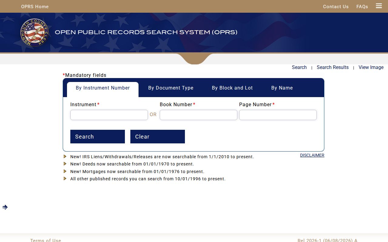
After the parcel is identified, OPRS adds a recorded-document trail to an address search in Neptune Township. Instrument Number search accepts an instrument number or book and page. Document Type search requires municipality, document type, and a From and To range. Block and Lot search uses municipality, block, and lot, or a date range. Name search requires a last or company name and allows a first name, document type, and optional dates. Results controls include the number shown and total records per page.
OPRS reports deeds from January 1, 1970, mortgages from January 1, 1976, IRS liens and related releases from January 1, 2010, and other published records from October 1, 1996. Its general interface limits a date search to 90 days. An empty result can reflect the range, record type, spelling, or online coverage. For older title work, use the County Clerk’s Freehold route rather than treating an online gap as proof that nothing exists.
Open the OPRS Property Records search after recording the parcel identifiers. The image shows the instrument, name, and block-and-lot search environment used to connect an address lead to an actual recorded document.
Save the instrument number, document type, recording date, party role, and book or page when available. A mortgage, release, lien, or judgment is a separate event and is not automatically a transfer of ownership. The County Clerk also cautions that the index is not accurate enough for title work. Compare the instrument image with the parcel identifiers, and use the Freehold title-search route when a continuous chain needs professional interpretation.
Neptune Township Street Records
A Neptune Township address trail is assembled from records keyed to a place, not from one official resident list. The assessor-facing property result provides a current parcel and owner lead. GIS supplies physical context. OPRS supplies recorded instruments. Municipal construction and code offices may hold a specific address record, but no public searchable municipal permit or code docket was found during the research. The election system can provide limited registration information through official channels, not a complete list of every person at an address.
| Address record | Custodian or source | What it can support | Access path |
|---|---|---|---|
| Assessment and parcel lead | Consolidated search; Neptune Tax Office | Situs, mailing lead, owner name, block, lot, qualifier | Online search; local assessment routing |
| Parcel geometry | Monmouth County GIS | Map position, parcel shape, nearby context | Online dynamic viewer |
| Recorded instruments | Monmouth County Clerk OPRS | Party roles, recording event, deeds, maps, liens | Online index and images; Freehold title route |
| Registration administration | NJ Voter Search; Monmouth elections | Limited official registration verification | Official search or lawful list request |
| Permit or inspection record | Neptune Construction or Code Enforcement | Particular property-file lead | Office request or focused OPRA request |
For a broad named-road question, start at the address level and repeat the same checks parcel by parcel. Do not combine names from separate sources unless the address, date, and record role actually agree. That discipline matters on a road with similar street numbers, unit qualifiers, or parcels that have been merged or divided.
Neptune Township GIS Checks
The Monmouth County GIS viewer is the map layer in a street-directory search. It is useful for parcel geometry, nearby context, aerial and base-map comparison, and checking whether two addresses refer to the same physical place. The text inspection could not verify its live layer names, parcel pop-up fields, or search controls, so those details should be read in the current viewer rather than assumed from a description.
Use the map as a cross-check after the consolidated property search identifies a township, block and lot. A parcel edge, road right-of-way, or label on the map does not prove who owns or occupies a site. When a block lies beside a municipal boundary or water feature, retain the map view as geography and confirm the legal property question with the assessor-facing result and recorded instrument.
Neptune Township Street Orientation
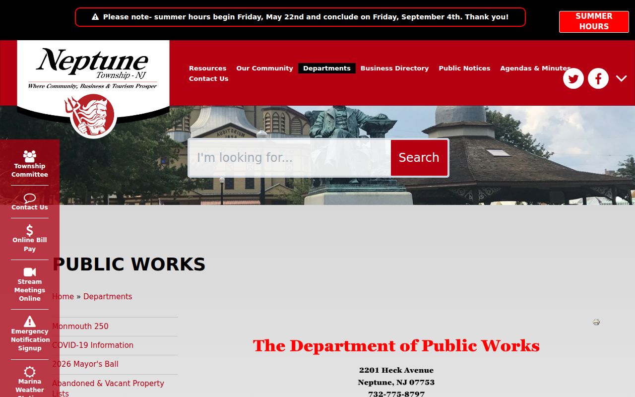
Use the Neptune Public Works resources for local street orientation, then return to county parcel tools for the legal record. Public Works links zone maps A through D, an Ocean Grove street map, and a Street Index. A service zone or street-map label can help identify the road, but it is not a parcel boundary and does not settle an ownership question.
The Public Works capture provides a Neptune Township street-directory orientation point for road names and municipal map resources.
Pair the street index with GIS and the consolidated search when an address sits near Ocean Grove, a waterfront edge, or a boundary with another municipality. The map identifies context; the parcel record identifies the legal search key.
Neptune Township Address Requests
Construction handles permit applications, certificates of occupancy, demolition, and sewer-connection forms. Code Enforcement handles property-maintenance and residential inspection matters. Neither municipal source yielded a public searchable permit or case index in the research. Ask the appropriate office for an existing record using the address and date range, rather than asking it to assemble an address list or identify everyone linked to a road.
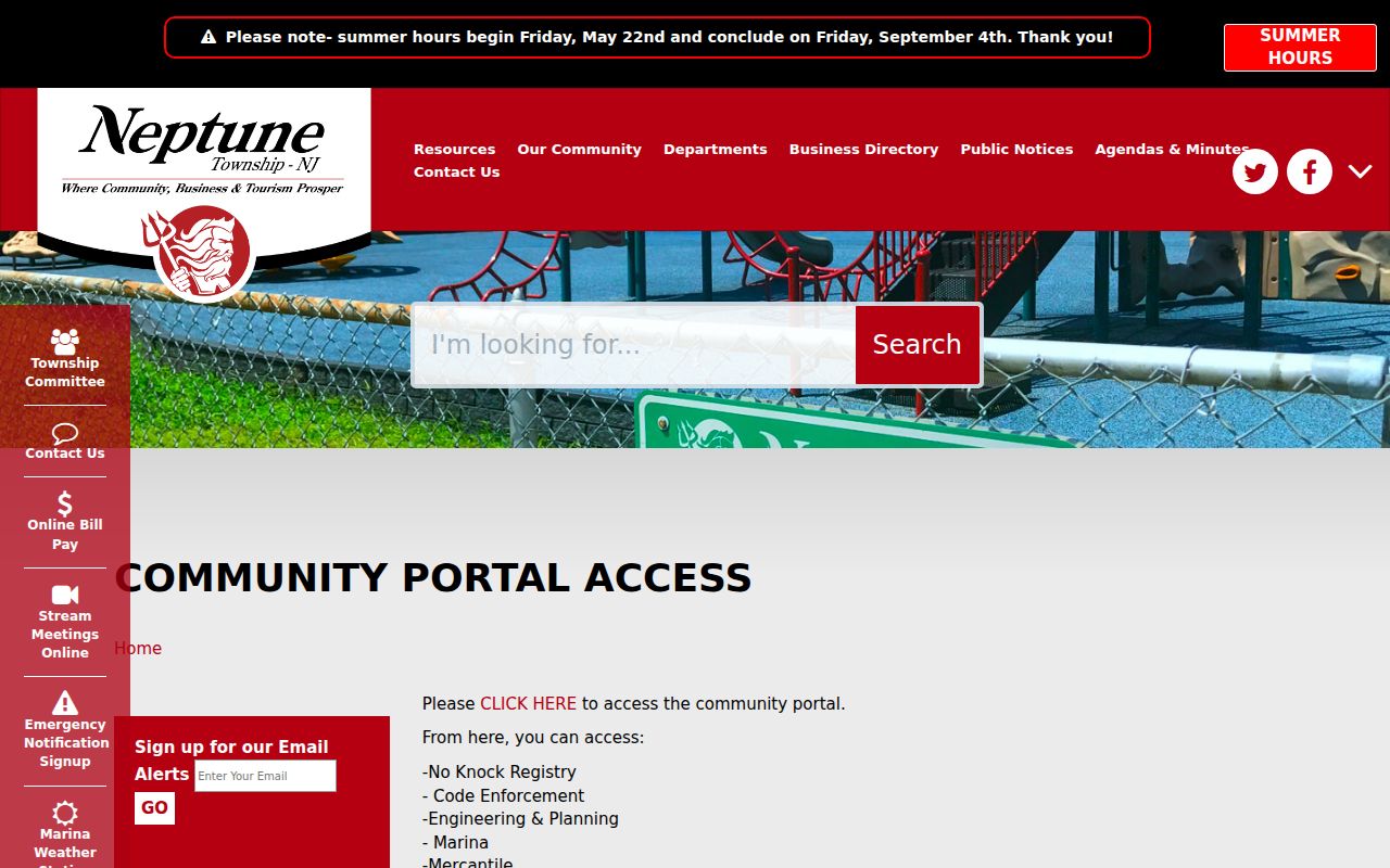
The Neptune Community Portal information shows the municipal online route for address-related services. It is useful for identifying the service channel, not for turning a service record into a resident list.
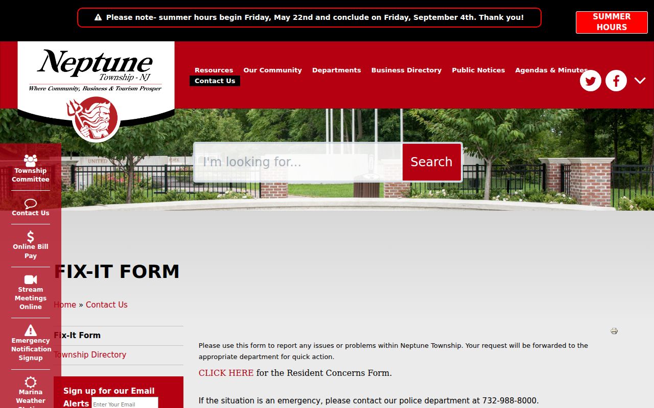
When a direct request does not produce an existing public record, use the Neptune Fix-It form only for its stated service-routing purpose. It asks for a location and issue, not proof of a person’s connection to that address.
For a releasable municipal record, the Neptune OPRA form supports inspection, pickup, mail, fax, or email delivery selections. Identify the particular record and custodian. OPRA does not require an office to create a new address history.
Old Neptune Township Street Names
Historic street research needs a wider place-name search. Neptune Township records can appear under Neptune, Neptune Township, Asbury Park, Ocean Grove, Bradley Park, West Grove, or Whitesville, depending on the date and publication. The State Library’s 1926 and 1928 Polk’s descriptions identify former Bradley Park, West Grove, Whitesville, and Neptune Township names. A hit under a neighboring directory title can still be relevant, but it needs a street, map, or parcel cross-check.
Midtown history supplies another useful caution: former Springwood Avenue became West Lake Avenue. Compare the printed street form in directories and newspapers with the modern GIS street form before discarding a result. Princeton’s Sanborn index identifies Neptune Township sheet 91 for 1918 and sheets 233 through 249, 528 through 535, and 540 for 1930. These maps show building and street context, not an occupant list.
Keep a small chronology for every older address. Note the source title, year, printed place name, street spelling, number, nearby intersection, and the modern parcel identifier used for comparison. A directory, newspaper, or Sanborn sheet may use a broad delivery name while the recorded instrument uses the legal municipality. That mismatch is a research clue, not a reason to silently convert the old wording. Mark an address connection as unresolved until the geography and date support it.
Note: Record each historical street spelling and community label beside the source year before linking it to a modern Neptune Township parcel.
Limits of a Neptune Township Street Directory
The records above provide narrow, dated leads. A parcel owner may use a different mailing address. A recorded party may be a lender, trustee, estate representative, or another document participant. An official voter result is governed by election rules and does not establish continuous presence. GIS proves geometry, not a person’s relationship to the parcel. Sensitive fields can be redacted, and protected addresses can be suppressed under New Jersey programs.
New Jersey’s Address Confidentiality Program and the Office of Information Privacy describe protections that can change what lawfully appears in a record. Use Neptune Township address records for personal, lawful research such as family history, estate work, public-record verification, or property context. Never build a dossier from partial matches.
Lawful use. Neptune Township address records have limits. Do not use parcel, map, voter, or directory material to stalk, harass, intimidate, or harm anyone.